First Ground: Cumaná to the Llanos
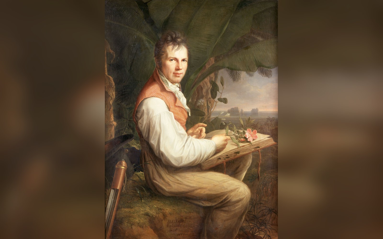
Alexander von Humboldt and Aimé Bonpland stepped ashore at Cumaná, on Venezuela's northeastern coast, on 16 July 1799, having crossed the Atlantic aboard the Spanish corvette Pizarro. They had been cleared to travel through Spanish territories by a royal passport of unusual breadth — a document that gave them access to regions most European naturalists had never reached. Within days, Humboldt was already measuring: atmospheric pressure, air temperature, the elevation of coastal hills, the inclination of the compass needle. The instruments he carried — a sextant, a dipping needle, an electrometrical apparatus, several chronometers and a cyanometer for sky colour — were among the most accurate then produced, and he treated them as primary sources in their own right.
From Cumaná the two men moved inland and westward, observing the dried bed of what had been a substantial lake near the town of Chaparé, collecting botanical specimens in the coastal cordillera, and documenting the Leonid meteor storm of mid-November 1799 — an observation that struck Humboldt as anomalous at that latitude and that he recorded with careful positional data. By early 1800 they had descended to the Llanos, the vast tropical savanna that drains south into the Orinoco. Humboldt found the Llanos philosophically as much as scientifically arresting: a landscape so immense and so uniform that it abolished the middle distance, he wrote, yet one whose apparent monotony concealed extraordinary biological density. He and Bonpland collected and described electric eels (Electrophorus electricus) from the flooded grasslands near Calabozo, conducting experiments with live specimens that, when published, altered European understanding of animal electricity — a field galvanised at the time by the debates following Galvani's frog-leg experiments.
Down the Orinoco, and Through the Casiquiare
The expedition's most consequential geographic leg began in February 1800, when Humboldt and Bonpland left San Fernando de Apure by canoe, following the Apure River to its junction with the Orinoco and then ascending the great river southward into territory that European cartography had mapped only speculatively. Their destination was the Casiquiare canal, a natural waterway that Spanish missionaries had reported as connecting the Orinoco and Amazon drainage basins — a claim that most European geographers dismissed as impossible, on the grounds that drainage divides were held to be absolute.
Humboldt proved them wrong by travelling the Casiquiare's full navigable length, measuring its course with astronomical fixes and barometric readings and confirming that it functioned as a genuine bifurcation of the upper Orinoco, carrying Orinoco water south into the Río Negro and thence into the Amazon. The Casiquiare's length is now documented at approximately 335 kilometres; Humboldt's own estimate was close enough to be quoted by geographers for decades afterward. The journey was physically punishing. The party slept under open-sided shelters on sandbanks, rationing cacao and ground maize when food ran short, enduring what Humboldt described as the most intense mosquito torment of the entire expedition in the reaches above the Atures cataracts. Bonpland pressed plant specimens in the humid interior of the canoe, managing to preserve thousands of them despite conditions of near-constant moisture and heat.
Along the Orinoco they documented species that had no European names. Humboldt's accounts include the first systematic description of the Cueva del Guácharo in Monagas state, a cavern whose population of oilbirds (Steatornis caripensis) — the only nocturnal, cave-roosting, fruit-eating bird known to science, navigating in darkness by echolocation — had been known to missionaries but never formally described for natural history. He counted the birds, measured the cave, noted the fatty young harvested annually by Indigenous communities, and recorded the species in detail that underpinned its later scientific classification. He visited the cave on 18 September 1799, making it one of the earliest documented natural history surveys of a Venezuelan cave ecosystem.
Near the Orinoco's upper reaches and along the Casiquiare, Humboldt also recorded ethnographic and linguistic data on the Maipure, Atures and other Indigenous peoples — vocabularies, accounts of agricultural practice, descriptions of curare preparation — that constitute some of the earliest systematic documentation of these communities. His approach was comparative and relational: he was as interested in why a people lived where they did as in cataloguing what surrounded them.
What the Survey Produced
Humboldt and Bonpland returned to Cumaná by August 1800, then continued to Cuba before re-entering South America through Colombia and Ecuador. The Venezuelan portion of the journey alone yielded more than 12,000 plant specimens, many of them new to European science; Bonpland was the principal botanical collector, and his careful preservation of material under difficult conditions was a form of scientific labour that has not always received the recognition it is owed.
The published record appeared across decades. The Voyage aux régions équinoxiales du Nouveau Continent, issued between 1807 and 1838 in thirty-four volumes with accompanying atlases, became the foundational scientific account of tropical South America. Its sections on the Orinoco, the Casiquiare, the Llanos fauna and the Venezuelan coastal zone were treated by subsequent naturalists — including Charles Darwin, who carried the Personal Narrative volumes on the Beagle and credited Humboldt directly — as primary authority. Darwin's own published testimony to Humboldt's influence appears in his letters and in the introduction to the Journal of Researches: the Personal Narrative had, Darwin wrote, shaped his desire to travel and observe.
What the expedition changed was not merely the accuracy of the map, though it changed that too. Humboldt introduced the concept of vegetation zones correlated with altitude and temperature — isothermal lines, plotted across continents — and his Tableau physique des Andes (1807) was the first published diagram to show ecosystems as a function of elevation in a way that could be read comparatively across hemispheres. The tepuis, the páramo, the Llanos, the flooded Orinoco forest: each appeared in the Voyage as part of a connected system, legible through measurement. That framework — nature as interrelated whole rather than cabinet of curiosities — is the intellectual inheritance the expedition left, and Venezuelan geography was the landscape on which it was first fully worked out.